City of Kirkland Launches Kirkland Activity Map
Published on December 02, 2021
Media Contact:
David Wolbrecht
Communications Program Manager
dwolbrecht@kirklandwa.gov
425-587-3021
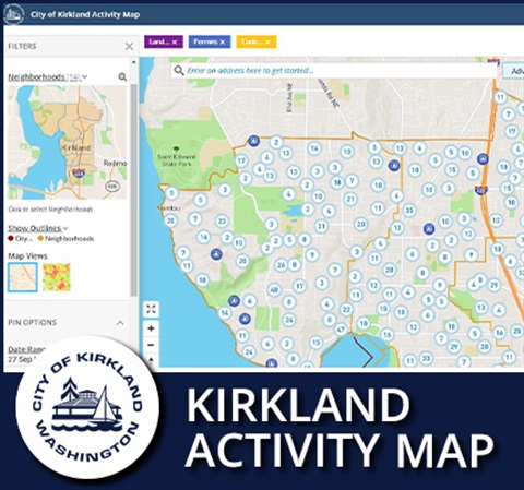
New Tool Will Help Community Members Track Building Permits, Land Use Permits, and Code Enforcement Activities
KIRKLAND, Wash. – The City of Kirkland has launched an interactive map for community members to learn about building permits, land use actions, and code enforcement in their area and throughout the city. The new Kirkland Activity Map is now available at https://kirklandactivitymap.connect.socrata.com and allows users to set up customized email alerts, focus on a selected location, and share a filtered view of the map.
“The new Kirkland Activity Map makes it easier than ever for our community members to be aware of development activity in their neighborhoods,” said Councilmember Neal Black. “Our city and region continue to experience growth due to it being such an amazing place to live, work, and play. We value transparency and want it to be easy for our community to get information about changes as they’re happening. This new tool will help do just that.”
The current data is sourced directly from the City’s permitting system, Energov, and is updated each day. The Kirkland Activity Map includes a guide for community members on creating email alerts for activity in their neighborhood. Future phases of the Kirkland Activity Map could potentially include additional activities, such as capital improvement projects, community requests received through Our Kirkland, crime information, and more.
This tool was developed by the City’s geographic information system (GIS) team, which oversees technology that is used extensively by almost every City department for managing, sharing, and analyzing map-related information. The GIS team also provides valuable information for the Kirkland community through a variety of interactive mapping tools. Earlier this year, the City received Esri’s 2021 Special Achievement Award for its innovative and efficient application of GIS technology. The City was one of the first governmental organizations in the region to host its GIS software and data entirely on cloud infrastructure.
To learn more and to discover additional GIS resources visit Kirkland’s CityHub ArcGIS Online site or the GIS Maps webpage.
###